
Rising Sea Levels Force Seawater into Thames Streets.
It hasn’t rained for hours, and there isn’t a storm offshore; the day is clear and calm and the sky is blue. But coinciding with the high tide on 26 November 2018 some of the streets in Grahamstown in Thames are still full of salt water.


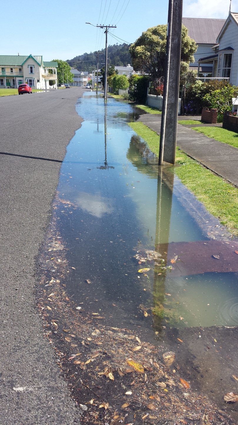
Monday 26 November 2018 was a reasonably high tide at 3.9 m, but it’s not even a “King tide” which can 4.4 m – a full half meter higher. This is sunny day flooding due to sea level rise. And it’s getting worse and more frequent as seas continue to rise.
In Albert, Brown, and Davy Streets in Thames the very pipes designed to reduce flooding by draining stormwater out instead give saltwater a pathway to flood the neighbourhood. There are floodgates which help to control seawater flowing back into the stormwater system. Maybe they were blocked or TCDC forgot to close them for this high tide?
Regardless, the photos dramatically show the level of high tides compared to the level of low-lying Thames streets. There is a very small margin before a storm surge and/or sea level rise swamp not just roads and footpaths but houses and businesses, as occurred on January 5 2018
It is not just Grahamstown which suffers from has groundwater flooding. Much of Thames foreshore has this tidal connection where the water table rises and fall with the tide and groundwater flooding has been identified as a problem on Waikato Regional Council flood maps. (green areas on the map)

Nor is this a problem unique to Thames. South Dunedin has suffered major groundwater floods and scores of towns and cities are experiencing sunny day or “nuisance flooding with high tides.
Our Councils and community need to act fast to identify the extent of this risk and find out what options we have to reduce it. The evidence is staring us in the face on high tides.
As Billy Bragg points out in his evocative song – “King Tide is A-Coming Bringing Flooding on a Sunny Day”
